 AUD
AUD
 USD
USD
 NZD
NZD
 GBP
GBP
 Euro
Euro


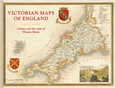
Victorian Maps of England: The County and City Maps of Thomas Moule
Batsford
- SKU:
- ING007
- Availability:
- Special order - usually ships in 2 to 4 weeks
Media: BOOK - hardcover, 160 pages
Author: T. Moule & J. Lee
Year: 2018
ISBN: 9781849944977
Other: colour maps, further reading
Publisher: Batsford
Previously we have sold individual county maps of England which were extremely popular. Unfortunately the publisher closed, and the maps went out of print. Now the most spectacular county maps of England are available again. This time they're reproduced all together in a large format A3 hardcover volume.
Thomas Moule was one of the finest Victorian mapmakers and is regarded as the true follower of John Speed in the cartographic history of Britain. Moule's beautifully observed county and city maps present a minutely detailed record of 19th-century England. They were first published in collectible parts between 1830 and 1837, and have been reproduced from time to time since.
Now the first time, this new large-format volume, comprising 55 county and city maps which are not only fascinating, as well as decorative and hugely informative, capture England's counties and key cities at a time when the Industrial Revolution and burgeoning railways were transforming the country. Even as Moule provided a minutely detailed record of these changes, he also celebrated the past through pastoral or monument views that are framed with the cartouches, festoons, and architectural ornament common during this period. Along with contemporary descriptions and extracts, the book explores Moule's career as a mapmaker and positions him alongside fellow Victorian pioneers including Brunel, Wedgewood, Bradshaw, Turner, Pugin, Blake, Scott, and Wordsworth.
Contents:
3 Reviews
-
Victorian Maps of England
I love maps. However I think this book is most valuable for the text written mostly by Thomas Moule which so far I've only dipped into.
It purports to be County and city maps. But this title is somewhat misleading. There are very, very few city maps - Bath, Boston, Cambridge and Oxford. However there are some "environs" maps that are less than a county. -
Simply Beautiful
This book is presented so well, its more than just for researching. The maps are worthy of framing and combined with much interesting reading. A must have for not only researchers, but for anyone that appreciates a fine book.
-
A Must Have Book for English Research
I love this book. Found it hard to put down as each page turned revealed another county and sent me on a search for places Victorian my ancestors lived. Well presented in easy to read A3 format, the old maps are a pleasure to search. Many have manor houses, churches and other landmarks identified. The illustrations of places shown on each map put the time in perspective. A definite research library addition.
Related Products

Victorian Maps of England: The County and City Maps of Thomas Moule
Related Products


